YUNNAN · UNDERSTANDING YOUR ITINERARY
Does the Tiger Leaping Gorge High Trail Include the Middle Gorge?
No. A Tiger Leaping Gorge High Trail walk does not automatically include a descent to the river in the Middle Gorge. An itinerary can finish its mountainside walking near the middle section of the gorge without taking you down to the river. The walking objective, exact finish point and any additional descent must be stated separately.
This distinction matters when comparing proposals: canyon views from above and a close view of the river are different experiences, with different access checks and physical demands. Before adding either to your trip, establish what is currently permitted.
Check the access position first
Access reviewed on 11 October 2026: the Shangri-La government notice published on 10 February 2026 explicitly lists the High Trail and Middle and Lower Gorge segments among undeveloped or unopened areas within Haba Snow Mountain Provincial Nature Reserve. It prohibits unauthorized hiking in the specified areas. This scope should not be extended into a claim that every Tiger Leaping Gorge attraction is closed.
A Diqing government report published on 21 September 2026, describing inspections on 19 September, records High Trail checkpoints, patrols, warnings and measures to turn back unauthorized hikers. We have not verified a later general reopening or general tourist permission for the named reserve areas. The notice's special approvals concern statutory purposes such as scientific work and rescue; they are not an ordinary tourist permit offer.
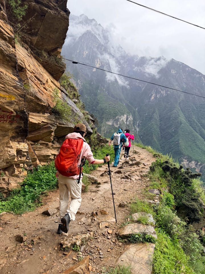
An old itinerary or a photograph of people walking does not establish permission for your dates. The comparisons below explain how to read a proposed itinerary; they are not instructions to enter a restricted path. Discuss currently permitted alternatives with the relevant local management and your travel planner.
Why the names cause confusion
“High Trail” describes the higher, mountainside walking experience. “Middle Gorge” can appear in travel descriptions as an area name, a stop in that area, or shorthand for a separate walk toward the river. Those meanings are not interchangeable.
An itinerary saying “finish in the Middle Gorge” may only identify where the walk ends and the onward transfer begins. It does not, by itself, specify a river-level visit. Similarly, reaching a road or guesthouse above the river is not evidence that the river descent has been completed.
For an example of itinerary wording, WildChina's published Ancient Trail programme describes Upper Trail walking, a guesthouse lunch and a transfer onward, without listing a separate Middle Gorge river descent in that day's activities. That is one operator's published description, not SHANLO's service specification or evidence of current permission. The useful lesson is to read the listed components rather than infer an extra activity from a place name.
Compare the actual inclusions
Scroll the table to compare the options
| Wording in a proposal | What it establishes | What still needs a separate answer |
|---|---|---|
| High Trail or Upper Trail walk | A stated mountainside walking objective | Exact start and finish, included sections and current permission |
| Finish near the Middle Gorge | A finish in or near the named area | Whether the finish is at road level or includes a river-level visit |
| Transfer from the gorge | An onward transport component | Pick-up location and how you reach it after the walk |
| Middle Gorge river descent | A separate lower-level objective is being proposed | The particular path, authorized access, full descent and return ascent |
| Developed gorge viewpoint visit | A viewpoint or attraction visit | The named attraction, current operation and its own walking requirements |
Ask for a plain-language answer: “Does this proposal include a river-level visit, or does the walking finish above the river?” If the answer is yes, request its separate description. A broad phrase such as “complete gorge experience” is not enough to define the activity.
Count the way back, not just the descent
A downhill extension can look small on a map and still add substantial effort. If the exit returns to a higher pick-up point, the descent creates an uphill return as well. Evaluate both directions, after the walking already completed that day.
Ask for the added distance, cumulative descent and ascent, surface and exposure, and any steps or ladders on the specific proposed path. These details belong to that path, not to every version of “Middle Gorge.” They also need to match what is currently allowed. A ladder photograph does not show the whole route or confirm its availability.
Avoid treating the extension as a standard extra hour. Walking pace, the chosen entrance and exit, stops and conditions change the time requirement. An estimated finish must also leave room for the onward transfer; deciding at the end of a tiring walk can create an avoidable conflict with a fixed departure.
For the demands of the mountainside walk itself, see our High Trail difficulty guide. Assessing that walk and assessing a lower extension are two separate decisions.
Choose according to the view you want
If your main aim is the broad canyon landscape, say that clearly. You do not need to collect every named segment for the journey to meet that aim. Start with an appropriate, permitted way to see the gorge, then assess the walking it actually involves.
If seeing the river from close by is essential, name it as a separate objective at the start of planning. Do not accept a High Trail label as confirmation that it is included. If the desired descent is restricted or unsuitable, ask which currently operating, authorized attraction could meet the viewing goal, and what compromises that alternative involves.
If you are connecting to another destination the same day, give the planner your departure arrangements first. Define the walking finish, access to transport and what happens if conditions change. An extension that fits a flexible day may not fit a day with a fixed connection.
Questions to settle before accepting a plan
- What exactly does “Middle Gorge” mean in this proposal: an area, a transport stop or a river-level walk?
- Where does the walking finish, and where is the pick-up?
- Is an additional descent included, excluded or only a possible option after access and suitability checks?
- If proposed, what are its separate walking figures and how do we return to the exit?
- Which named paths or attractions are currently authorized for our dates, and who has confirmed this?
- What permitted alternative and booking arrangements apply if the proposed activity cannot take place?
For a wider destination decision, read Tiger Leaping Gorge versus Yubeng. For combining the areas within a Yunnan journey, see our Tiger Leaping Gorge and Yubeng planning overview; it does not make every named trail an inclusion.
SHANLO discusses outdoor trekking and mountaineering journeys across China, with Yunnan and Western Sichuan as key areas. Share your preferred view, travel dates, recent walking experience and onward plans when enquiring about tailor-made China travel. The proposal should state the permitted activities, walking boundaries and agreed services before you book.
SHAPED AROUND YOU
Tell us which gorge experience matters to you.
Share your dates, walking experience and onward travel plans. We can discuss suitable, currently permitted options and the services to confirm before booking.